
 |
| The Cantino planisphere, c. 1502. |
The Cantino planisphere is the earliest-surviving map that shows Portuguese discoveries in Asia and South America up to 1500.
The map is a guidebook to their voyages, its detail showing where they had ventured, and less or none where they had not. It contains considerable accuracy of both the west and east coasts of Africa, which by that time they had thoroughly explored. To the east beyond Africa the detail fades, along the coast of India and into Asia.

The map shows little beyond that to the east. Europeans of course knew that China lay not far beyond, and the fabled Spice Islands lay to the southeast, but they had yet to map those lands out.
It is worth mention, also, that alongside cold geographical detail, Europeans still saw in maps like this the myths and legends popularized by Marco Polo, Sir John Mandeville, and others.

Toward the top is Cuba and above that, Europeans' first glimpse of Florida, while farther down, the map outlines the coasts of Venezuela and Brazil.
At this point the map shows us the world view of Magellan and his crew, who were, basically, journeying south off the end of the map.
Making this prospect scarier, the farthest point previously reached to the south along this coast was Rio de la Plata, near modern-day Buenos Aires. There, the Portuguese explorer Juan Díaz de Solís, after leading a successful expedition, had a few years earlier been captured by cannibals and eaten in clear view of his crew, who looked on from their ships offshore.
As for the Cantino world map, the Portuguese protected all knowledge of their discoveries. It was a crime to take maps and other documents out of the kingdom. The Portuguese were building a lucrative trade route around the Cape of Good Hope and up to India with armed forts spread along the way—all largely unknown to most of Europe at the time.
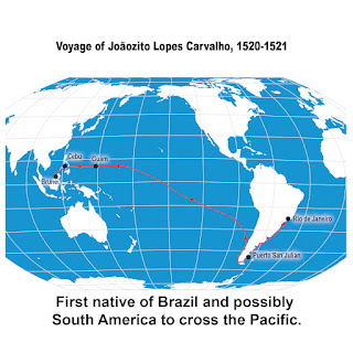
Ferdinand Magellan’s historic journey swept up several unlikely travelers along the way, among them a seven-year-old boy at Guanabara Bay (Rio de Janeiro). Half-Portuguese, half-Tupi Indian, he is remembered in history as Joãozito Lopes Carvalho. The young boy became the first native of Brazil and likely all of South America to cross the Pacific Ocean—on a year-and-a-half journey that for him ended at Brunei five hundred years ago this summer.

Antonio Pigafetta's account of the Magellan-Elcano voyage gives us both first-hand historical detail and color—the human aspects of the journey. The Italian scholar learned all he could about the cultures that Magellan's fleet encountered, even sitting down and recording samples of languages.
An excellent example of Pigafetta's curiosity and fascination is his description of the coconut and the palm tree, which he learned about soon after the fleet's arrival in the Philippines. Like the pineapple Magellan tried in Rio, the coconut was an unknown. "Cocoanuts are the fruit of the palmtree. Just as we have bread, wine, oil, and milk, so those people get everything from that tree. Read more.
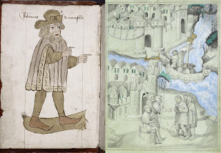
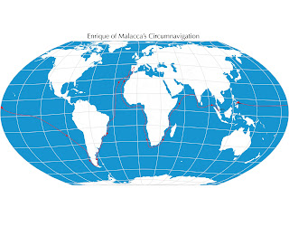
It gets little mention today, but The Travels of Sir John Mandeville was a world atlas of sorts in medieval Europe, essential reading for navigators and explorers. The accounts became circulated widely in Europe in the fourteenth century. They detail travels in North Africa and the Middle East, and in India, China, and even the Malay Peninsula—which would have been of particular interest to Ferdinand Magellan, and also Enrique of Malacca, Magellan’s interpreter-slave. Read more.
Reni Roxas and Marc Singer brought the story of Enrique to life for children in First Around the Globe: The Story of Enrique. Twenty years on they released this anniversary edition in 2017 from Tahanan Books, Manila. Read more.
- EnriqueOfMalacca.com
- Enrique of Malacca on Twitter
- Enrique of Malacca on Facebook
- John Sailors / Enrique on Medium
- And, yes, Enrique might be 500 years old, but he was known as a kid, so of course he's now on Instagram too.